.png?width=489&height=100&name=DS%20VTM%20Logo%20Horizontal%20-%20Color%20Light%20(2).png "DS VTM Logo Horizontal - Color Light (2)")
Share this
by DroneSense on 10/23/23 9:03 PM
In the ever-evolving landscape of drone technology, one fundamental truth has become abundantly clear: the success of drone operations relies on the strength of the ecosystem supporting them. Drones are no longer just flying gadgets; they've become invaluable tools for public safety. To harness the full potential of these uncrewed aircraft, a robust and cohesive ecosystem is essential. As the only software platform that seamlessly integrates all aspects of the drone ecosystem, DroneSense not only simplifies operations but also ensures that each piece of the puzzle functions harmoniously.
Ushering in a New Era of Public Safety with Next-Level UAS Technology
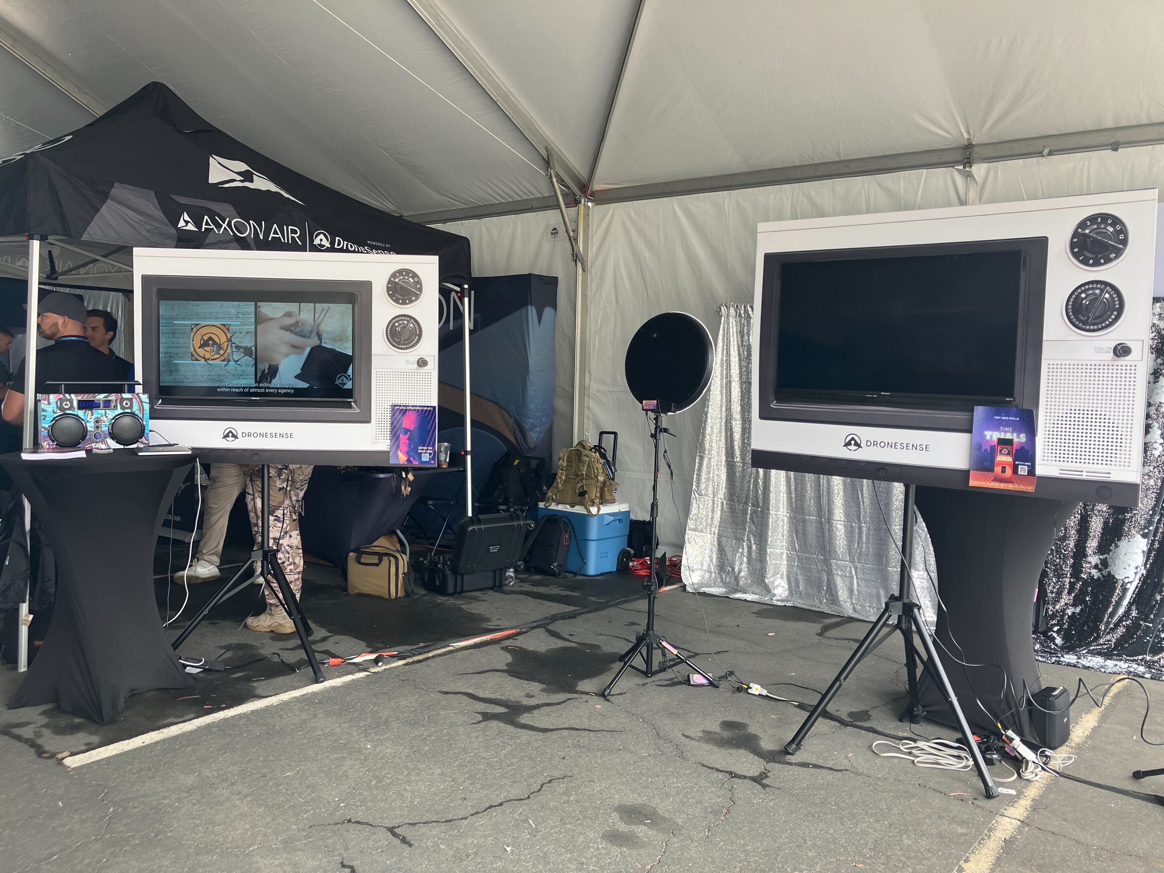
Dock Integration: Elevating Efficiency in Drone Operations
With our Dock Integration, public safety agencies can now seamlessly use the DJI dock to automatically launch, control, and recover their aircraft, ushering in a new era of efficiency and effectiveness. This innovative addition simplifies the entire process of launching and retrieving drones, making it more streamlined and accessible than ever before.
By automatically handling launch, recovery, battery charging, and other operations that traditionally require human intervention, Docks form a critical element of a fully autonomous drone program. Drones can be prepped and launched with remarkable ease, ensuring that they are swiftly deployed to where they are needed most.
With cloud-based operations, the Dock Integration opens doors to fully remote control and monitoring, further enhancing the flexibility and reach of public safety missions. Drones can be operated from virtually anywhere, providing real-time support even in remote or challenging environments. This level of connectivity is crucial for ensuring the safety of both the public and first responders.
Airspace Awareness: Enhancing Safety and Situational Awareness
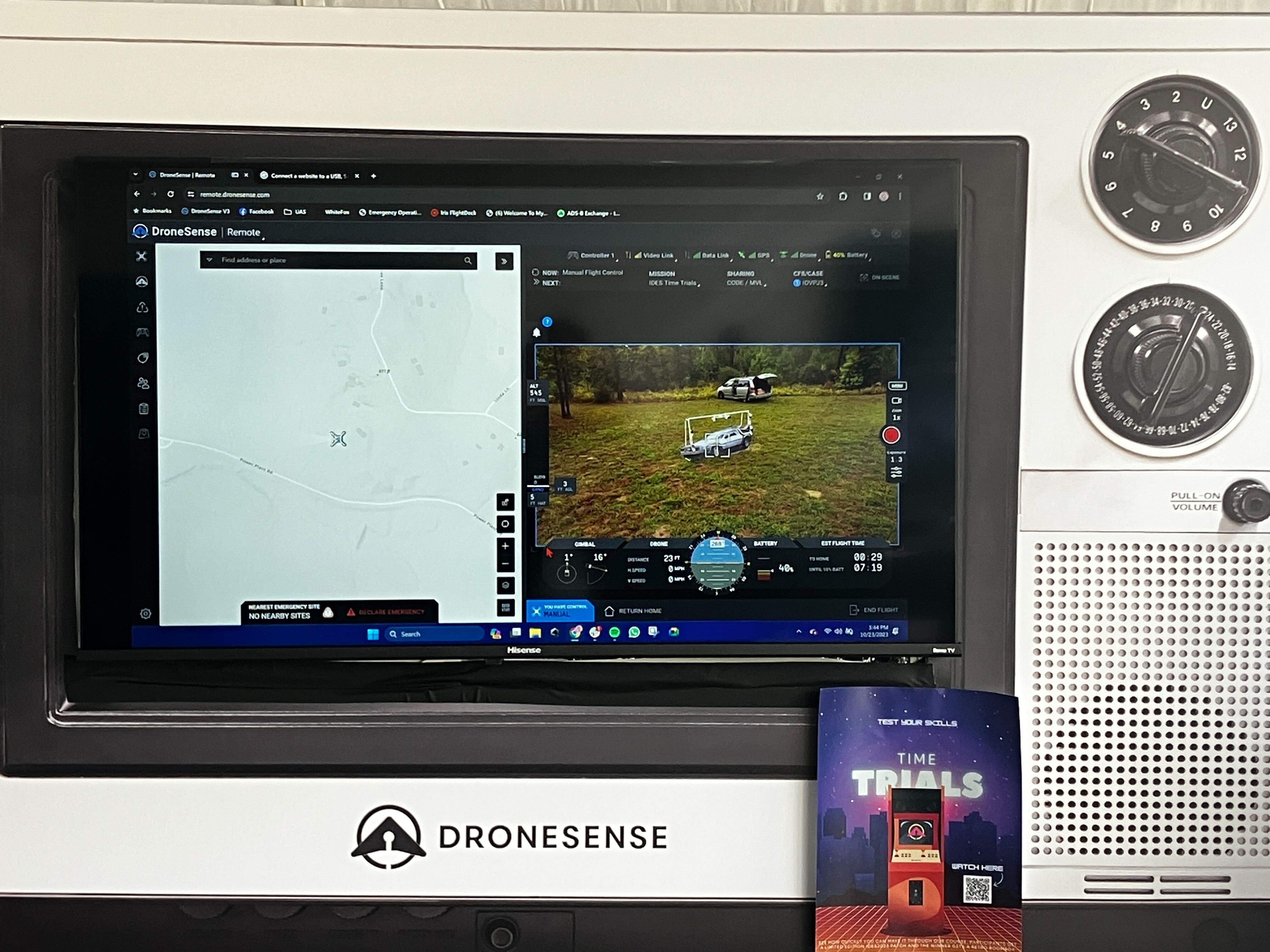
In the world of public safety, information is power. Our Airspace Awareness integration empowers public safety agencies with the real-time data they need to effectively and efficiently launch remote operations. Gone are the days where a visual observer (VO) must be on the roof with the drone. With Airspace Awareness, we deliver critical insights including the presence and location of other crewed and uncrewed aircraft, and dynamic airspace restrictions.
Whether it's monitoring a natural disaster, tracking suspects, or conducting search and rescue missions, Airspace Awareness offers a significant advantage. Agencies can adapt their drone operations on the fly, avoiding potential conflicts and guaranteeing that their missions proceed without interruption.
Terrain Following: Boosting Drone Performance in Varied Landscapes
Public safety missions often take place in dynamic and challenging environments, from rugged terrain to disaster-stricken areas. Our Terrain Following feature has been designed to tackle these challenges head-on. This revolutionary technology enables drones to maintain a consistent altitude above the ground, regardless of varying topography.
The result is a safer mission, without worry that your investment will crash into an object mid-flight. The Terrain Following feature allows drones to navigate uneven landscapes, steering clear of obstacles and changes in elevation.
CoPilot: Seamless Streaming for Enhanced Flexibility
Our CoPilot app is a significant advancement for public safety agencies. It fosters a new level of compatibility and flexibility in drone operations, allowing personnel to seamlessly stream video, even with previously unsupported drones.
Imagine a scenario where different agencies use various drone models or have existing drone equipment that they need to utilize effectively. CoPilot bridges these gaps, allowing for easy integration of diverse drone fleets. This compatibility streamlines the process of live streaming video, ensuring that critical information is readily accessible to teams on the ground.
CoPilot's real-time streaming capabilities are invaluable during public safety operations. It facilitates quick decision-making, enhances situational awareness, and enables agencies to collaborate seamlessly, whether it's during a fire response, a police chase, or a disaster recovery effort.
We’re so excited to share our new integrations and features, designed specifically to provide public safety agencies with the tools they need to navigate complex and dynamic environments. The Dock Integration, Airspace Awareness, Terrain Following, and CoPilot app streamline operations, enhance safety, and elevate the quality of your missions. These innovations empower public safety agencies to better serve and protect their communities, underscoring our commitment to provide the best, most innovative technology for public safety drone programs.
From tactical to remote operations, DS is the most comprehensive drone management and collaboration platform on the market.
To learn more about how our new integrations and features can take your drone journey to new heights, don’t hesitate to reach out to our dedicated team.