
Share this
by DroneSense on 11/14/22 7:47 AM
The Marine Corps Marathon, managed by the US Marines in Arlington, VA and the nation’s capital, is one of the largest marathons in the US and the world.
Hosted annually in the Arlington, VA and the nation’s capital, the 47th Marine Corps Marathon took place on October 30, 2022 and was set on a scenic course that started halfway between the Pentagon and Arlington Memorial Cemetery, continuing through Rosslyn before journeying into the District to tour Georgetown and the National Mall, covering 26.2 miles until the finish line at the Marine Corps War Memorial. The largest marathon in the world that doesn’t offer prize money, the Marine Corps Marathon attracted about 30,000 runners from all over the United States and other countries and many thousand guests that lined the course along the way.
Providing safety and security for an event of this size was a top priority for Marine Corps Marathon organizers as well as the event’s law enforcement partners. The use of uncrewed aerial systems (UAS) or drones became a crucial part of the plan – however orchestrating flights and missions along the Potomac river and marathon route was not without challenges. After all, the airspace around Washington, D.C. is more restricted than in any other part of the country.
A Crowded Airspace
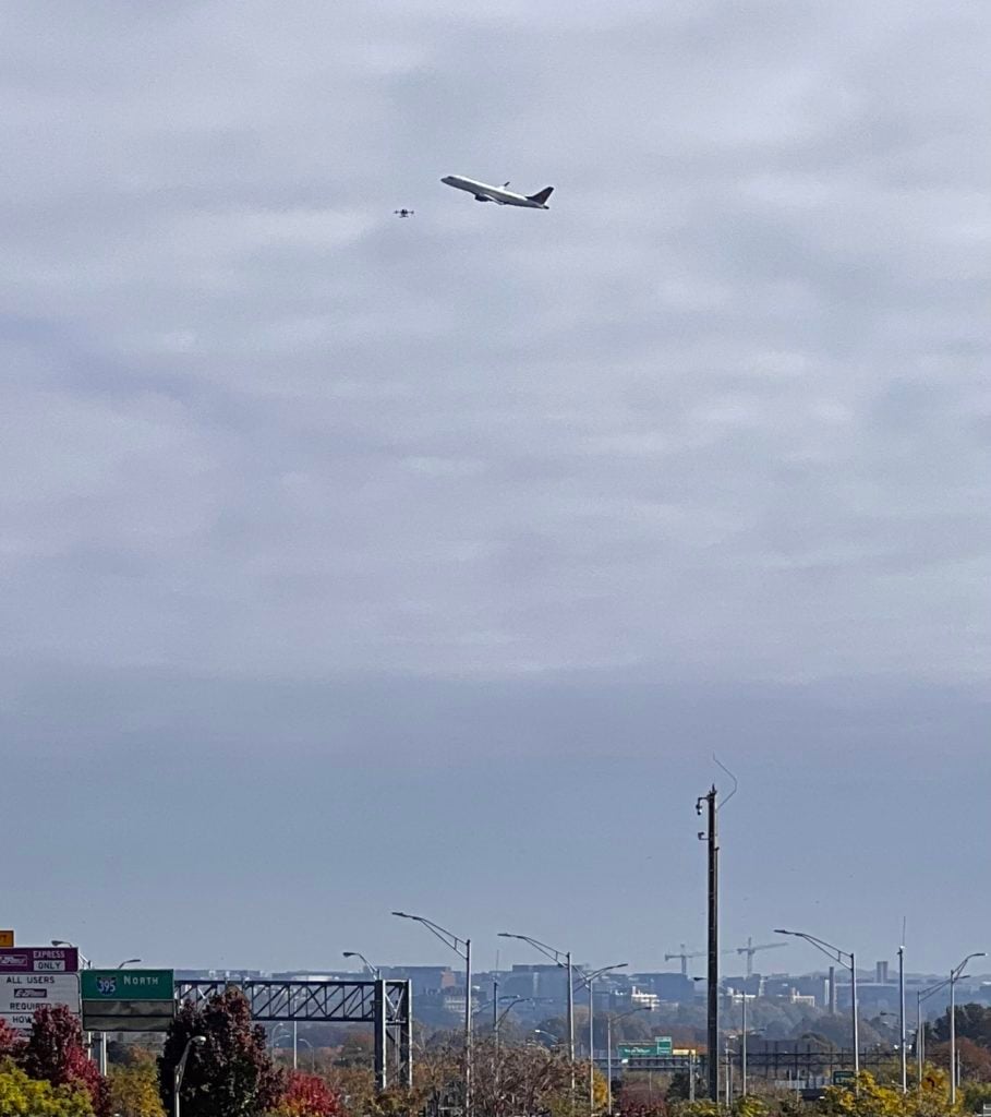
The Washington, D.C., metropolitan area is served by three major international airports: Ronald Reagan Washington National Airport (DCA), Washington Dulles International Airport (IAD), and Baltimore/Washington Thurgood Marshall International Airport (BWI). Furthermore, Andrews Air Force Base (Andrews AFB, AAFB) is located close by in suburban Washington, D.C.
The National Capital Region is governed by a Special Flight Rules Area (SFRA) within a 30-mile radius of Ronald Reagan Washington National Airport, which restricts all flights in the greater DC area and is divided into a 15-mile radius inner ring and a 30-mile radius outer ring. Flying an uncrewed aircraft within the 15-mile radius inner ring is prohibited without specific FAA authorization. Rules put in place after the 9/11 attacks establish “national defense airspace” over the area and limit aircraft operations to those with an FAA and Transportation Security Administration authorization. There are prohibited areas surrounding the White House, the National Mall, and the Vice President’s residence in Washington, D.C., and the FAA regularly institutes temporary flight restrictions (TFRs) for security reasons during special events.
Drone Operations
By working closely with the FAA, the TSA as well as the ATC from National Airport (DCA), a special waiver for drone operations for this event was obtained. As if maneuvering rules and regulations for operations in this area and obtaining special permits wasn’t challenging enough, operations and collaboration with all of the various agencies and stakeholders had its own set of challenges. From communicating and visually presenting the area of operations, restrictions and no fly zones, ensuring pilots remained within mission parameters and compliant with the conditions of the waiver at all times, to sharing the location of authorized drones that were part of the mission with all stakeholders, an easy-to-use tool that could be accessed by all parties involved was needed. After all, a mistake entering a prohibited area with a drone, or an authorized drone being mistaken for a bogey could have severe consequences.
At its core, the mission required a secure and easy-to-use software to provide comprehensive situational awareness during the event. This included ultra low latency sharing of the drone video feeds as well as video feeds from other video streaming devices like mobile devices with all stakeholders.
Making it Happen
Helping first is a core value for DroneSense. So when the DroneSense Team was approached about assisting with drone operations for the Marine Corps Marathon, we responded by sending some of our best and brightest.
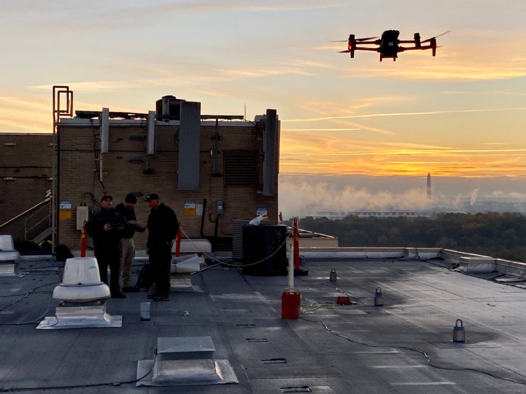
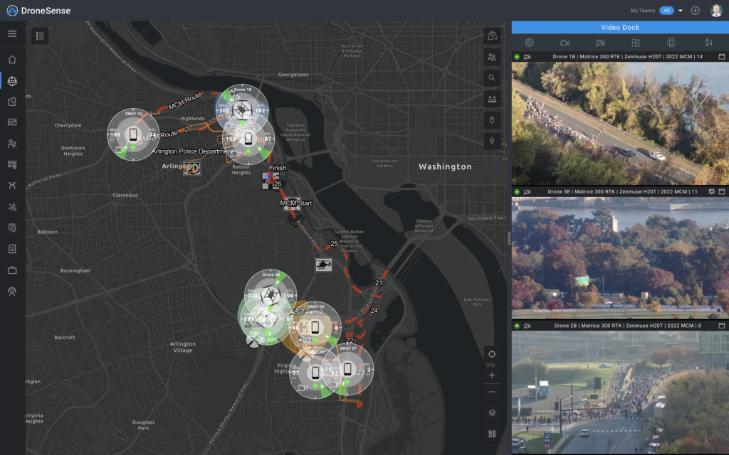
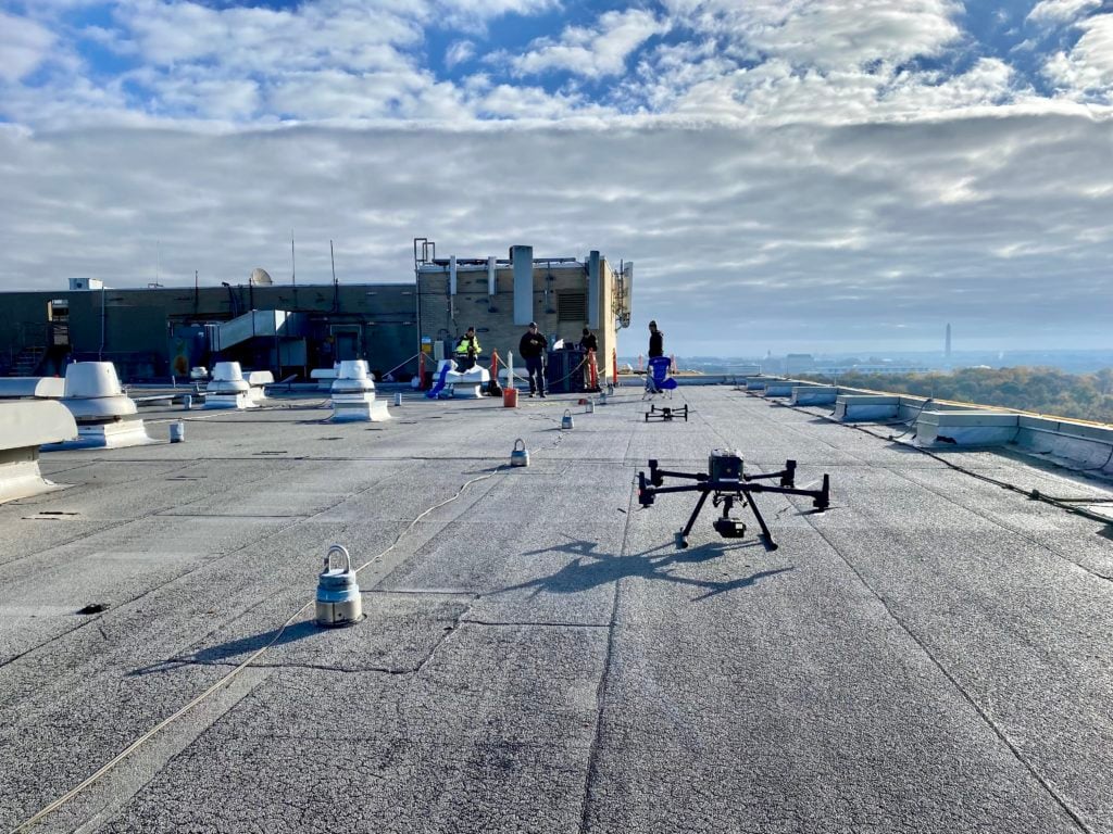
Five law enforcement agencies under the leadership of the George Mason University police drone unit came together, providing drones and staffing for the mission. Three rooftop launch sites were selected. One air boss was identified, coordinating all take-offs, landings and flight operations, essentially becoming the air traffic controller for all drone operations. The George Mason University drone unit created a mission in the DroneSense software that was shared with all other agencies partaking in the effort in order to coordinate efforts and provide all stakeholders with comprehensive situational awareness.
Map preparations like geofencing, clearly marking the route of the race and labeling special points of interest on the map began even before the event started, helping brief all stakeholders involved the day of the event.
Internet connectivity for the launch sites was provided through the use of Starlink systems. Based on communication with a constellation of low Earth orbit satellites, the Starlink system delivered reliable connectivity during the event, carrying multiple video feeds without introducing much latency in a densely populated urban environment with tall buildings.
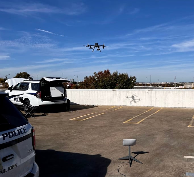
Drone flight operations began at 6:00 am from all three launch sites, with continuous drone coverage all day long, and seamless swapping of aircraft for battery changes to maintain an aerial presence at all times
During operations, the value of having the zones of operation clearly identified in the map view, with perimeters indicated on the DroneSense map, was critical to both pilots and stakeholders. Being able to quickly identify in what direction a drone was looking at by having a special point of interest (SPOI) marker on the map furthermore helped with orientation and situational awareness.
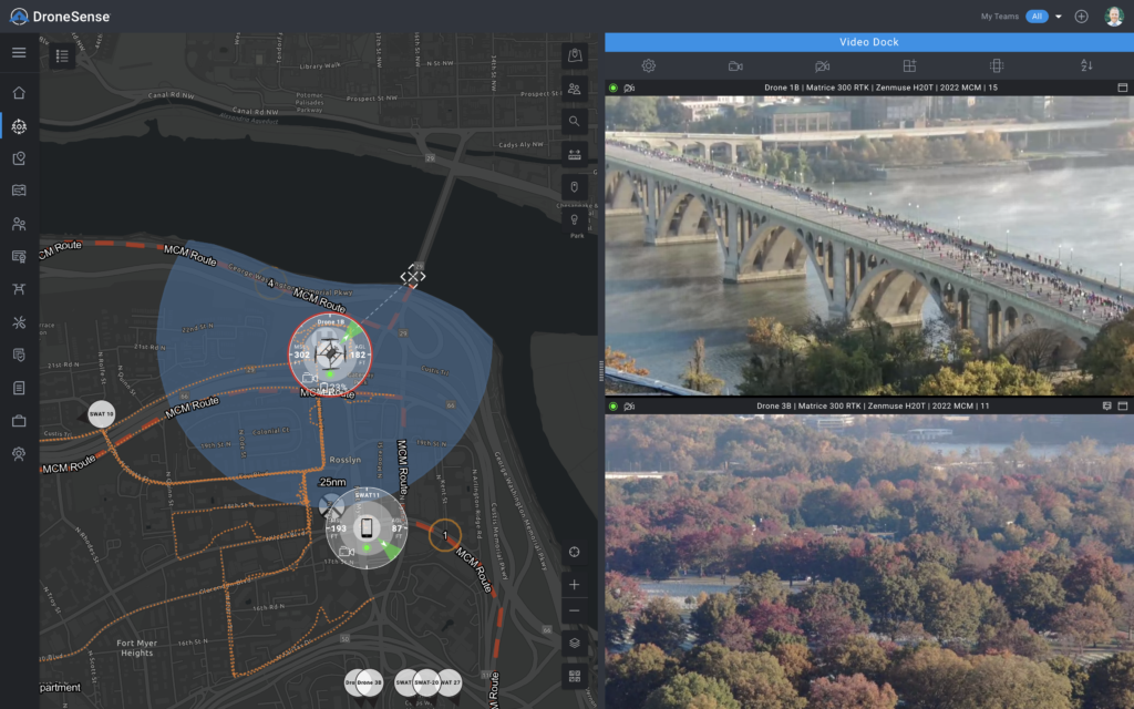
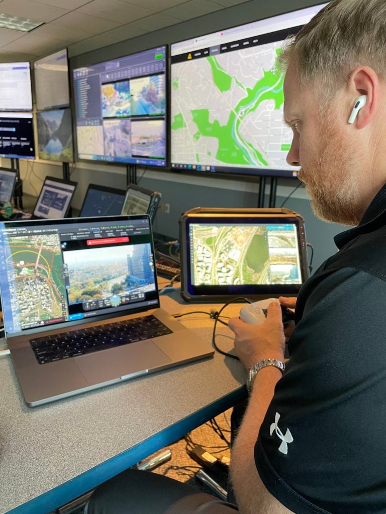
But stakeholders and command staff at the operation center weren’t just able to see the location of airborne assets; by using the DroneSense mobile streaming and tracking software feature (MSAT), ground units operating with mobile devices were able to join the mission and have their location indicated on the map view as well, making it easy to have an overview of available assets on the ground that could be dispatched and directed to nearby areas of concern.
In Conclusion
The 2022 Marine Corps Marathon began at 7:55 am, with a Howitzer sounding the official start of the race. The first runner to cross the finish line did so less than 2 hours and 20 minutes later. The race remained open for runners to finish until 3:00 pm, but the day didn’t end for first responders until much later.
The successful drone operations for the event not only proved that it was possible to safely fly uncrewed aerial systems in such a regulated and busy airspace, but it also demonstrated the value of having drones provide a unique perspective, or an “eye in the sky”, for first responders to augment their level of situational awareness while covering such a large event and area.
Sharing critical insights with other agencies and stakeholders to have that comprehensive situational awareness is a game changer for large events, and where the DroneSense software really stands out as a platform.
As Chief Lighthiser summarized “Several years ago I would have believed this mission to be impossible. Today, we flew immediately adjacent to the approach into DCA, right next to the Pentagon and across from all the big landmarks in DC.” He continued “The mission was a large success due to the support of the DroneSense team.”.